Forty Years of City Building at Urban Strategies
Michel Trocmé, September 2026
Forty years of practice mark an opportunity to reflect on what lies behind the places we help create. Urban Strategies’ work ultimately takes physical form in neighbourhoods, campuses, waterfronts and public spaces, but it begins with a strategic framework. Simple organizing ideas that clarify ambition, align diverse interests, navigate complexity and establish the conditions for places to evolve over time.
The Strongest plans don’t eliminate complexity –
they make it understandable.
The complexity and messiness of modern cities is not something to be designed away, but rather to be coordinated through the essential elements of a framework which organizes everything else around it, integrating community aspirations, urban design, infrastructure, policy, economics, landscape, mobility and implementation. In doing so, they give public agencies, private partners, institutions and communities a shared language for making decisions and for carrying a vision forward over time.
Form Follows Framework
A successful framework doesn’t attempt to predict the final form of every building, street, landscape, or public space. It doesn’t tie everything down. Rather, it establishes the underlying relationships that allow many people, disciplines, and decisions to contribute to a coherent whole as the place grows and evolves. This principle lies at the heart of Form Follows Framework. The quality of the places that emerge depends on the strength of the structure established at the outset: how streets connect, where public life gathers, how infrastructure supports growth, how landscape shapes identity, and how development can unfold incrementally without losing sight of the larger ambition.
At the same time, a strong framework leaves room for the qualities that give cities their vitality: adaptation, changing uses, local businesses, unexpected opportunities, and the sometimes-messy interactions of everyday urban life. It provides direction without over-designing the future. What are the essential ideas that can organize complexity and provide a foundation for long-term change? This question remains constant, whether revitalizing a downtown, transforming an industrial waterfront, creating an innovation district, renewing an existing neighbourhood, or establishing an entirely new community.
The six projects that follow offer different answers. Together, they show how Simple Plans can coordinate ambitious undertakings while leaving room for buildings, landscapes, public spaces, and communities to acquire richness and character over time.
Re-Centering the Urban Core:
Campus Martius, Detroit MI
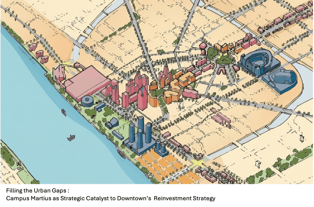
Against a backdrop of decades of population decline and disinvestment, by the mid-1990s downtown Detroit contained pockets of activity that operated largely in isolation. The distances between them were short, but the experience of moving between them was not. People tended to drive from one area to another rather than walk, leaving gaps between districts that diminished downtown’s coherence. A quickly hand-drawn “Jellybean Diagram” captured this condition: lively districts appeared as colourful jellybeans, separated by uncomfortable gaps that weakened the downtown as a whole. The drawing was hardly sophisticated, but it helped to change the conversation. What had been understood as ‘leftover space’ began to be understood as downtown’s greatest opportunity.
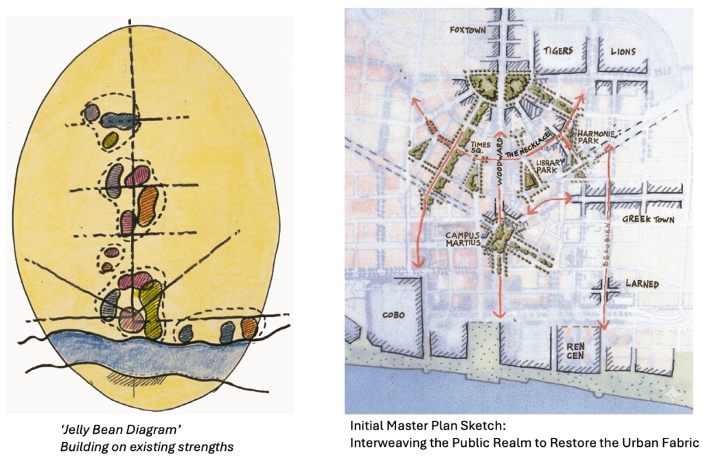
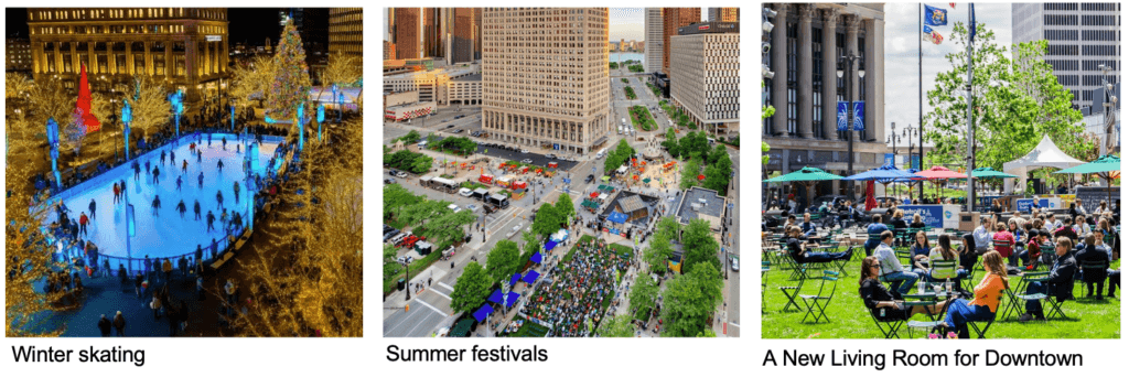
Initial explorations focused on reinvesting in downtown’s urban fabric by re-weaving its public realm. The largest open space was Campus Martius, a vast intersection at Detroit’s historic heart and a forlorn remnant of Judge Woodward’s heroic 19th-century plan for the city. Rather than asking how this oversized intersection might be redesigned, we asked a different question: What if it became downtown’s living room?
That simple shift in thinking became the foundation of a broader strategy connecting public life, mobility, identity, and reinvestment. Early sketches imagined a civic square with active edges, welcoming public spaces, and reasons to return throughout the year. More than a redesigned intersection, the plan created a new focal point for downtown—a compelling public space around which its broader revival could take shape.
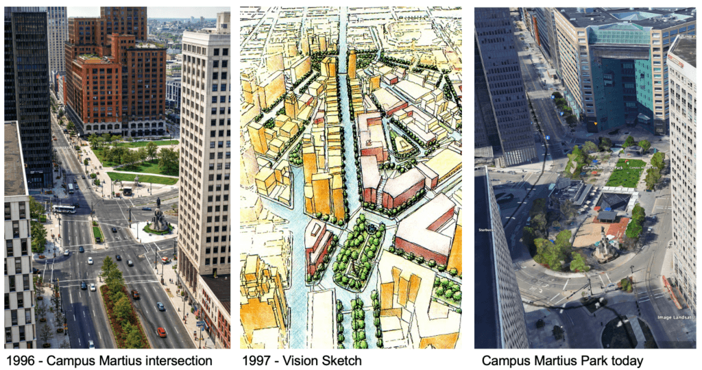
Campus Martius didn’t create Detroit’s ambition. That emerged from the determination of the city’s communities, businesses, institutions and civic leaders. Our initial contribution was to reveal how this neglected gap could once again become the heart of the city. We then guided its implementation through more detailed master plans, managing an international call for development partners to work with the city in bringing the plan to life.
Structuring an Innovation District:
Kendall Square Research Park, Cambridge MA
Our ambition for Kendall Square Research Park, a well-located but derelict industrial site, was to create, borrowing Seinfeld’s famous phrase, a place “about nothing” in particular. Rather than relying on a single theme, signature building or institutional presence to define it, its identity would emerge organically from the mix of people, uses and everyday life. It would emerge from the quality of its streets, squares and public realm. But first, our plan needed to break through a wall of buildings that enclosed the site (a legacy of its former use as a coal gasification plant) and find ways to reconnect it to the surrounding community. The site’s proximity to the MIT campus offered tremendous synergies. The project succeeded because our client embraced a simple but transformative idea: the world’s best researchers are drawn not only to great laboratories, but to great places. The concept we developed therefore moved beyond the isolated research-park model in creating a district where scientific work, city life, and informal exchange could coexist.
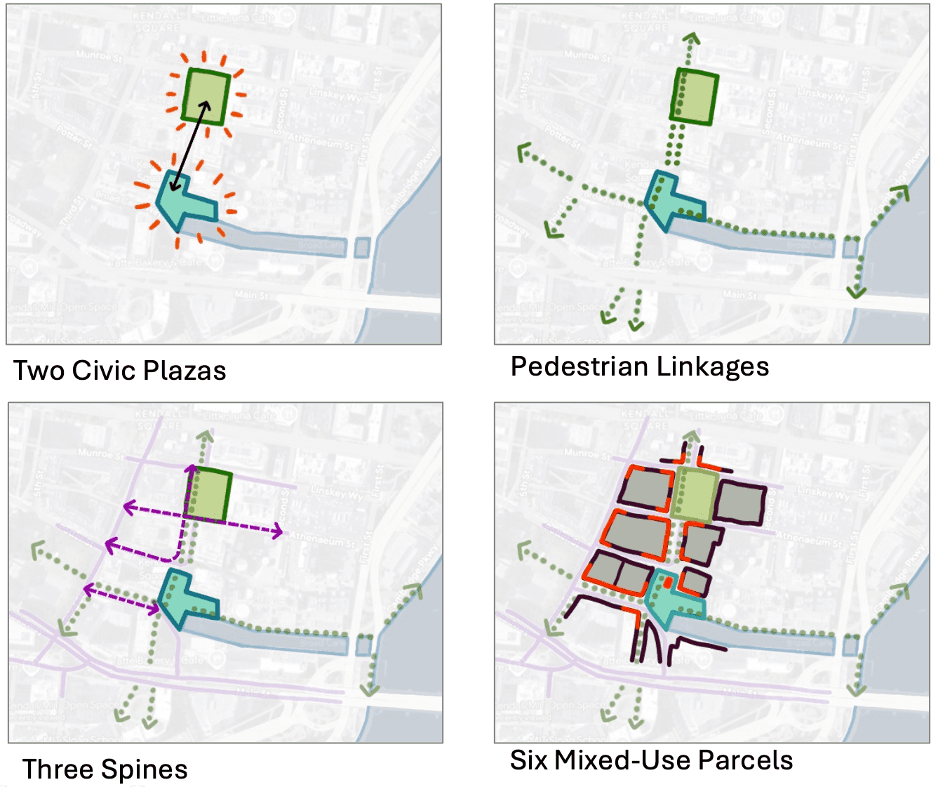
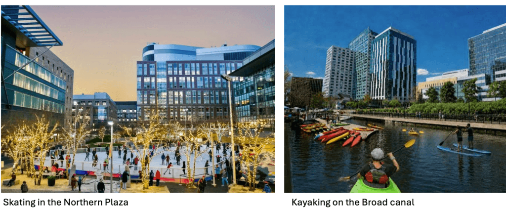
That ambition was translated into a series of simple structuring ideograms beginning with a classic “dumbbell plan” of two civic plazas connected by a central pedestrian spine. One square became the social heart of the district, animated by cafés, restaurants, markets, and seasonal events. The other opened toward a former industrial canal, extending walking and cycling connections to the Charles River. Between them, a simple sequence of streets and blocks created a framework which wove the site into its surrounding fabric, creating an ensemble of walkable urban blocks within which many development partners and their architects could work. Laboratories, offices, homes, shops, restaurants and cultural uses arrived incrementally, each contributing variety without weakening the larger urban structure.
Weaving the Urban Fabric:
Canada Water, London
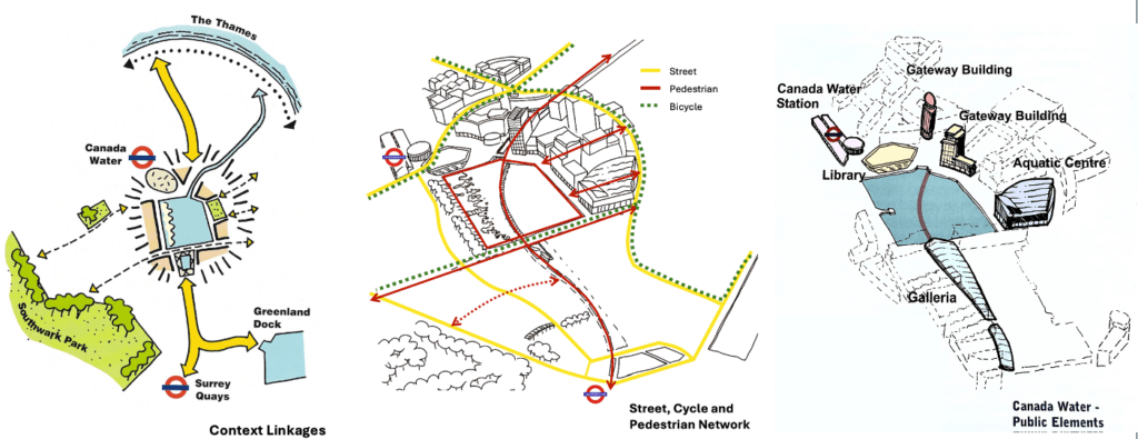
At the heart of the London Docklands, Canada Water had become a fragmented landscape of underused land and water, derelict buildings and disconnected roads. A new London Underground interchange in 1999 set the stage for transforming this vacancy into the heart of existing and emerging communities, completing a missing piece of London’s urban fabric.
How could the dock connect neighbourhoods rather than separate them? The answer was deceptively simple: create a new civic focus beside the water, directly adjacent to the transit hub. Framed by residential buildings and a public library, this waterfront plaza became the district’s community hub, a place for gathering, meeting, and enjoying the dock as a shared civic asset.
The structuring framework wove together a connected network of streets, public spaces, pedestrian routes, and development blocks that extended into the surrounding neighbourhoods, stitching the dock back into the city. Water was no longer an edge but the defining landscape around which the district could grow. It balanced development capacity, movement, land use, and public space while remaining flexible enough to respond to changing market conditions and support phased delivery.
Following the completion of the plan’s initial phases in 2006, development has continued around the dock. Although some uses have changed (including the replacement of the enclosed shopping mall) and densities have increased, the area continues to evolve as a connected piece of city in keeping with the spirit of our simple framework.
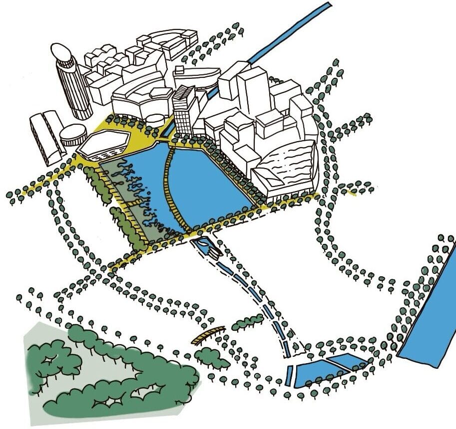
Green and Blue Network
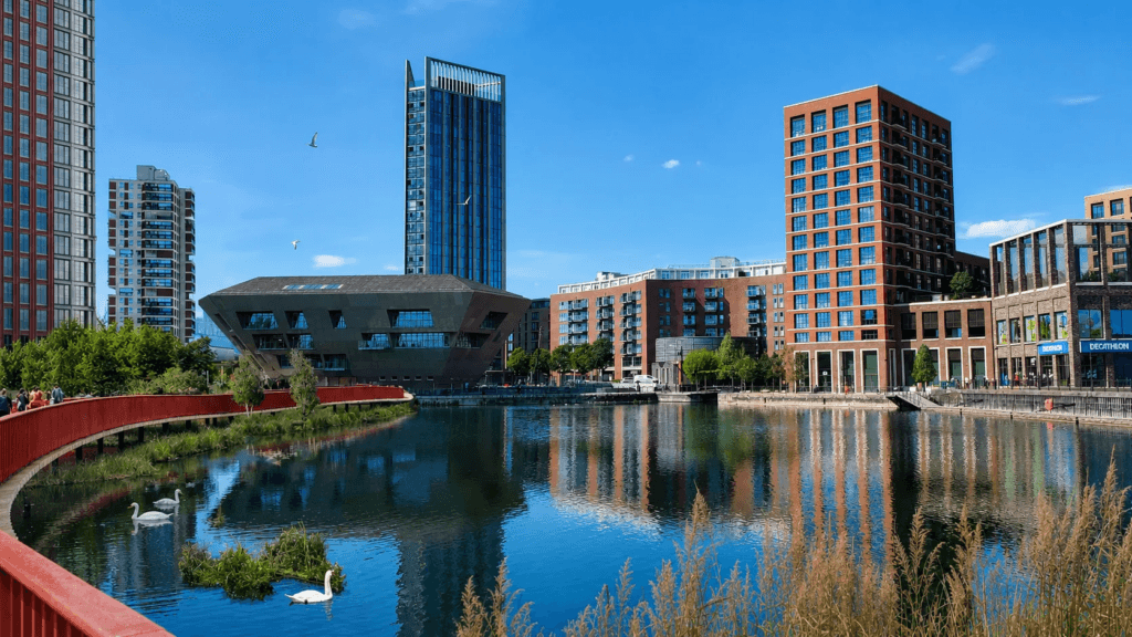
View from across the Canada Water dock
Revitalization Through Partnership:
Alexandra Park, Toronto
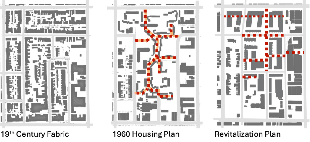
“Zero Displacement” wasn’t simply a housing target at Alexandra Park, a 1960’s social housing community in central Toronto that faced aging buildings, physical isolation, and the need for substantial renewal. Keeping its vibrant community whole was the commitment around which the entire revitalization was organized. The residents who had built lives there were keen to remain part of its future. For more than a decade, the community, Toronto Community Housing, a private development partner, and the design team have partnered to make that possible.
The needed renewal had to extend well beyond replacing buildings. Alexandra Park’s inward-looking superblock design had disconnected the neighbourhood from the surrounding city. Streets ended abruptly, buildings turned their backs on public spaces, and fragmented open spaces lacked a clear purpose. Through two years of community meetings and workshops, residents helped define what should change, and what should remain.
From those conversations emerged a set of diagrams which expressed the community’s design ambitions and framed our plan as it evolved: reconnect Alexandra Park to the city while creating a strong sense of place within it.
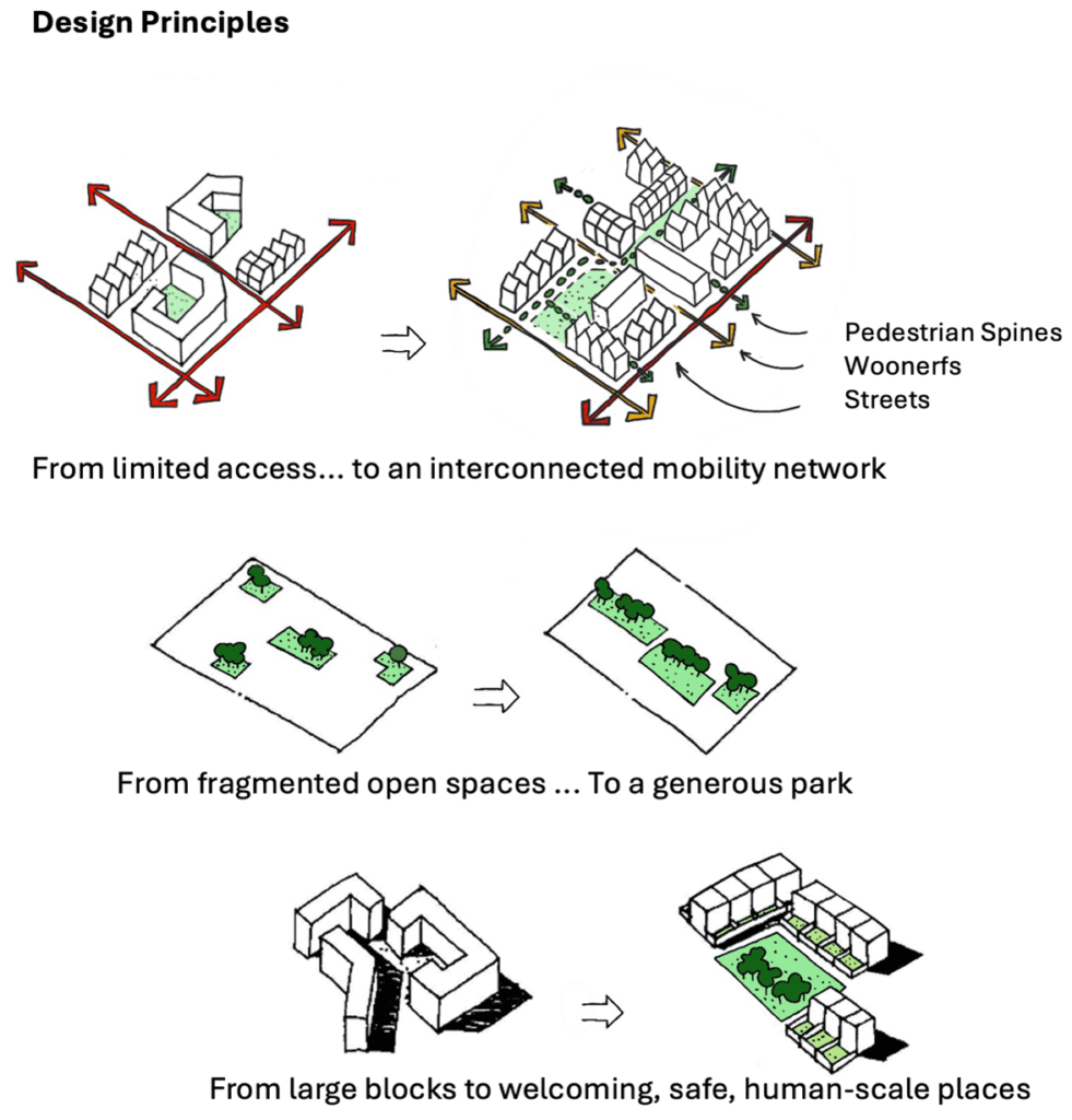
New streets and blocks extended the surrounding urban fabric into the neighbourhood. A generous central park replaced scattered leftover spaces, while new homes framed streets and public spaces with active frontages, improving safety and supporting everyday interaction. Market housing was integrated with replacement affordable homes, creating a more socially mixed neighbourhood without displacing existing residents.
The physical plan appears straightforward, masking a myriad of complexity. Delivering it has required the careful resolution of interwoven social, financial, infrastructural and phasing dynamics, and, above all, the creation of a partnership strong enough to sustain the vision through time.
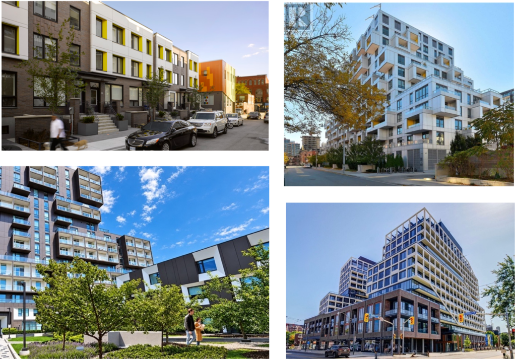
Alexandra Park Today
Rooting Community in Landscape and Memory:
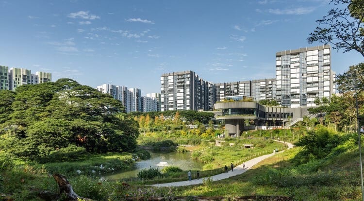
Bidadari, Singapore
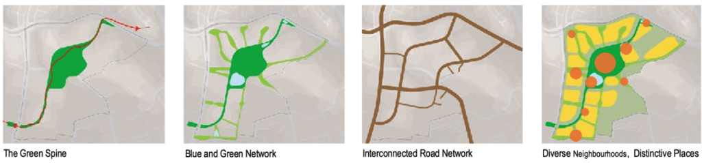
A Landscape-Oriented Framework

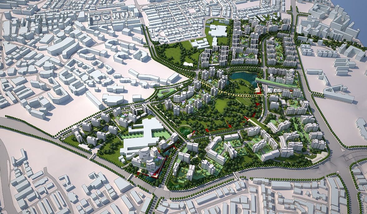
More than 10,000 homes have been delivered at Bidadari in just over a decade, a lightning speed of delivery that leaves all other social housing agencies in the dust. Behind that pace and scale, however, lies a quieter idea: A Community in a Garden. Bidadari occupies the site of a former cemetery, a landscape with mature trees, waterways, ecological value, and layers of cultural memory. The challenge wasn’t simply to accommodate Singapore’s ambitious housing objectives, but to create a high-density community without erasing the qualities that made the site distinctive.
Rather than fitting parks into the spaces left over after development, the plan began with a Landscape-Oriented Framework. Parks, green corridors, waterways, and civic spaces formed the primary structure, establishing the foundation around which the community was organized. The plan also integrated migratory bird flight paths, keeping trails and lighting away from primary refuge areas to protect birds during peak migration seasons. Housing, schools, community facilities, transit, and streets were then arranged around this network. Walking and cycling routes connect residents to schools, recreation, transit, and one another. Elements of the site’s history are embedded within the landscape, allowing the new community to inherit a sense of continuity.
The phrase “A Community in a Garden” is easy to understand. Making it real required coordinating housing, ecology, transportation, infrastructure, heritage, and public life. That’s the work a ‘Simple Plan’ must do: hold many systems together without allowing complexity to overwhelm the central idea.
Placemaking Through Infrastructure and Ecology:
Ookwemin Minising, Toronto
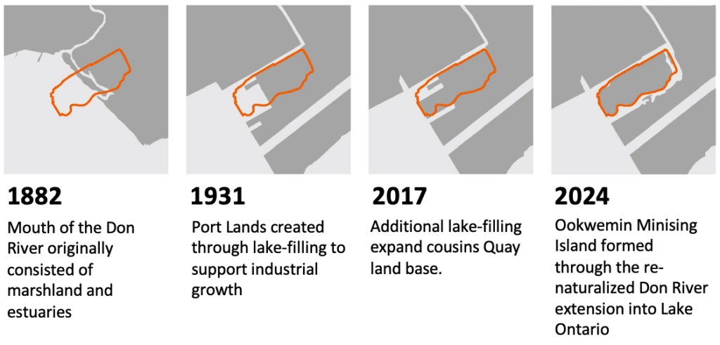
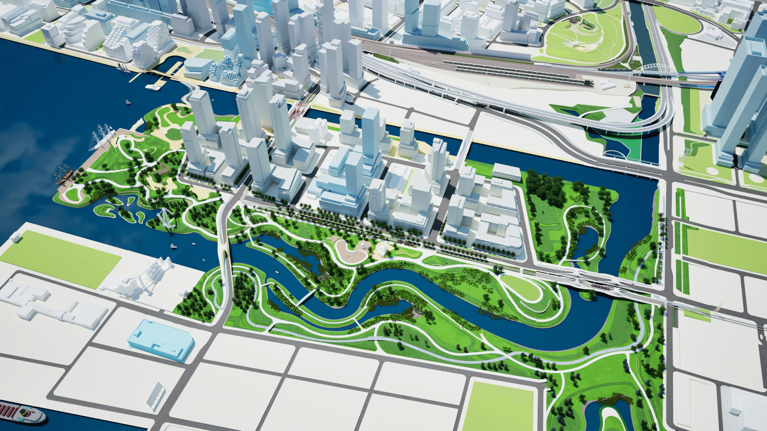
The Evolution of Ookwemin Minising
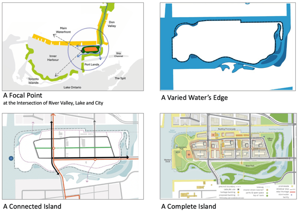
Some places begin with a site. Ookwemin Minising began by creating one. Once a flood-prone, industrialized landscape cut off from Toronto, the Port Lands required a massive re-naturalization of the Don River to form a brand-new island. Our task was to translate this new geography into a complete piece of the city. Through extensive community conversations, we established a clear urban framework of streets, development blocks, parks, and waterfront promenades. The plan addresses complex urban challenges: honouring Indigenous and industrial heritages, balancing ecology with density, and integrating a new community into a newly created island.
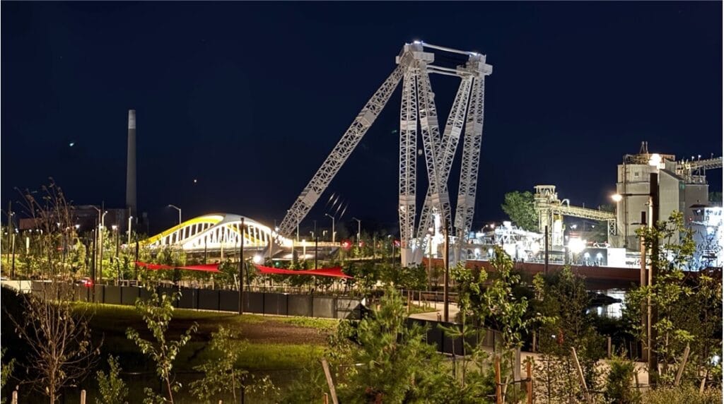
Today, the landscape is completely transformed: the river construction is complete, and the spectacular Biidaasige Park has quickly become a major public draw. Attention has now shifted to the everyday human experience—the streets, buildings, and public spaces. Architects, landscape architects, engineers, and development partners are now adding detail and bringing the district to life. Their individual contributions will give the neighbourhood richness and variety, but their success depends on the essential framework that connects them.
Ookwemin Minising shows how infrastructure and ecology can become the foundation for city-building. Rather than beginning with individual buildings, the plan establishes the conditions for a resilient, connected urban community to emerge over time.
Six Frameworks, One Approach
Each project began with a different question:
- How do you give a downtown back its heart?
- How do you make innovation urban?
- How do you stitch fragmented city fabric back together?
- How do you renew a neighbourhood without losing its community?
- How do you make density feel connected to nature?
- How do you transform a re-emerging landscape into an urban community?
The answers were different because each of the places were different. Yet each depended on an organizing idea clear enough to build confidence, coordinate decisions, and be carried forward by others. In each case, that framework began with a public-realm (“landscape-first”) move: strengthening a network of streets and active-mobility routes, restoring ecological corridors, reconnecting people to water and landscape, or creating the public spaces and places around which urban life could gather. These moves established the physical and civic structure within which development, architecture and change could follow.
That may be the real value of a ‘Simple Plan’. It gives people a shared way of understanding what matters, while leaving enough room for the city to evolve in ways its original planners couldn’t anticipate.
Cities are never finished masterpieces. Their vitality comes from crowded sidewalks, cafés spilling into streets, neighbourhood festivals, local businesses, spontaneous initiatives, changing uses and the gradual layering of a variety of architecture and a spontaneity of public life. That productive disorder, the delightful messiness of cities, isn’t a flaw to be eliminated. It’s a quality to be supported.
Perhaps the two greatest compliments a framework plan can receive are that others take credit for it (a sign they have made it their own) and that, over time, people forget there ever was a plan in the first place. They simply experience skaters in a downtown square, workers meeting in a neighbourhood café, children playing in a park, residents walking through greenways, or people cycling and paddling along a restored riverfront. The places feel as though they’ve always belonged.
Daniel Burnham urged generations of planners to “Make no little plans.” He was right about ambition. Forty years of practice have taught us that bold ambitions are often realized through simple frameworks: clear enough for many people to understand, flexible enough to respond to change, and strong enough to guide countless decisions long after the original designers have stepped away.
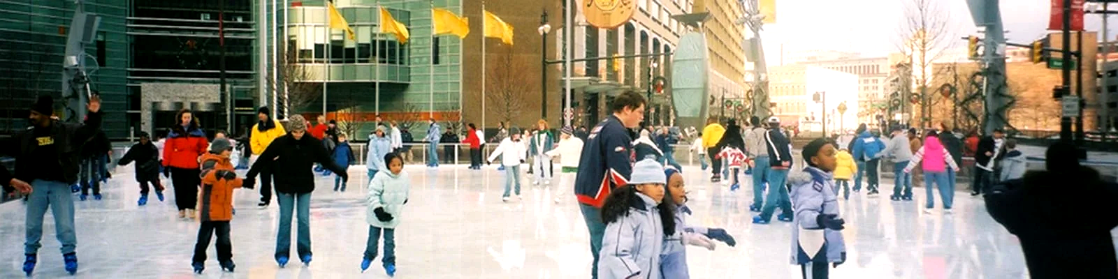
Downtown Detroit
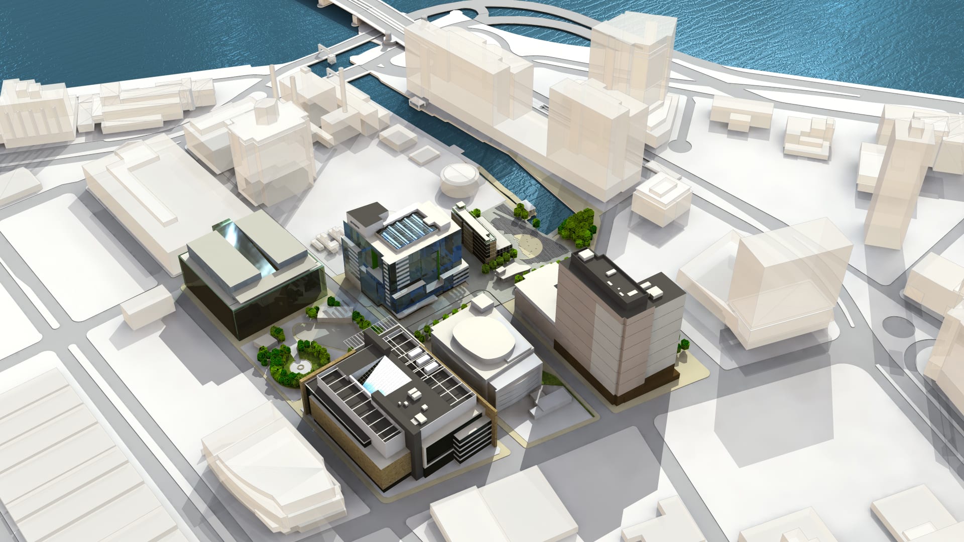

Canada Water Vision and Masterplan
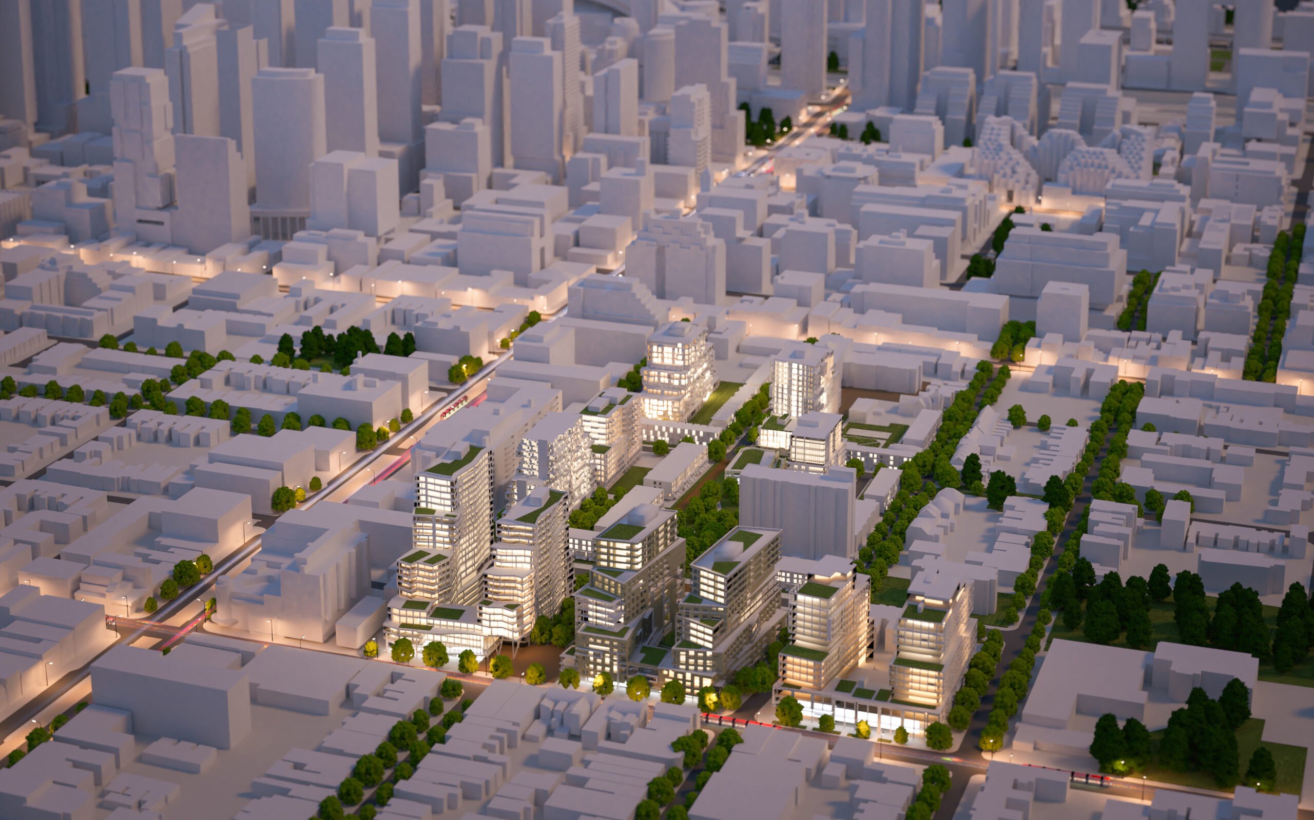
Alexandra Park Revitalization
Urban Strategies worked with the Toronto Community Housing Corporation (TCHC) to develop and implement a revitalization plan for the Alexandra Park neighbourhood. This is an 18-acre social housing development built in the 1970s in Downtown Toronto.