2006
London Planning Award, Waterfront Renewal
2005
Canadian Institute of Planners Award for Planning Excellence in International Development
2005
Waterfront Center Honor Award
As the lead consultants on a range of redevelopment and visioning projects in the area, Urban Strategies has prepared master plan documents for lands totaling approximately 570 acres within the docklands, with a built-out yield of approximately 40,000 new residential units, and commercial space to accommodate approximately 20,000 new jobs.
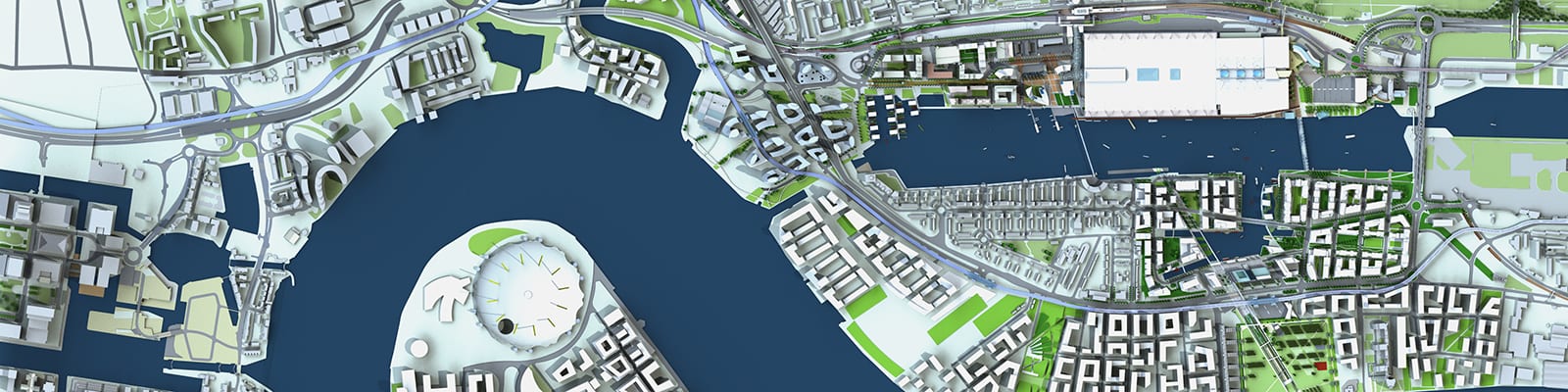
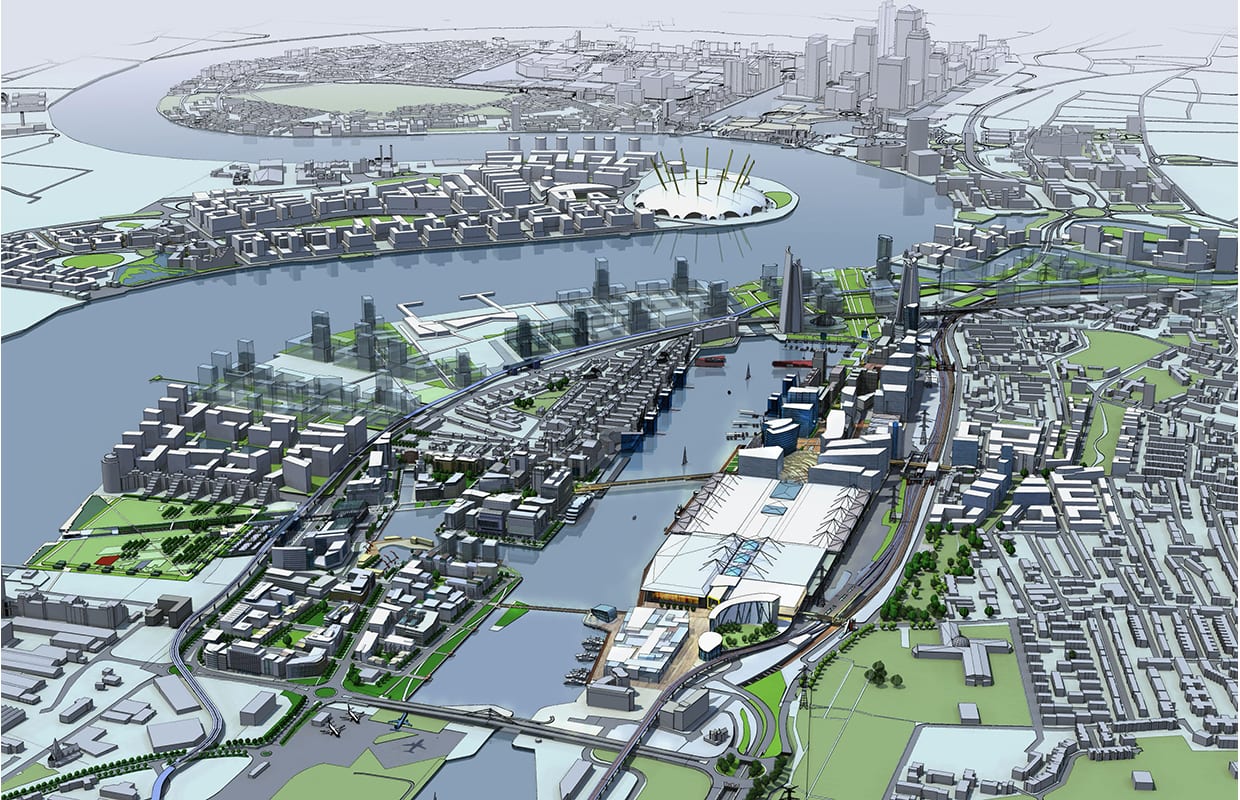
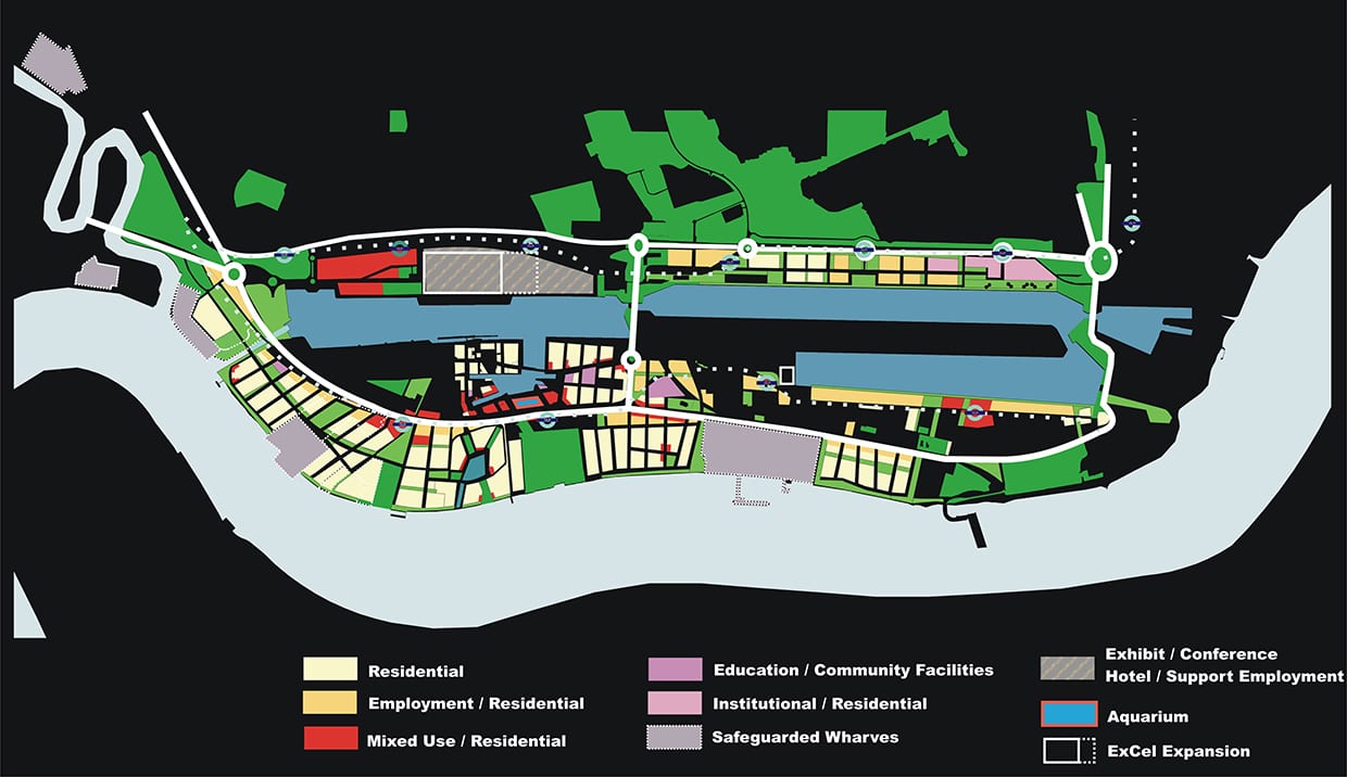
Urban Strategies has played an ongoing role in the regeneration of the London Docklands, a former heavy industrial district located along the Thames River in East London. Since 1988, Urban Strategies has been involved in reshaping the Dockland area and has acted as the lead consultants on a range of redevelopment and visioning projects in the area. In advance of the Olympic opportunity, Urban Strategies assessed the Docklands’ full redevelopment potential and prepared an innovative new Vision for the industrial 570 acre Royal Docks area. Our Vision provided the strategy to transform the area into a mixed-use, transit-oriented ‘city within the city’ that builds on light rail investment, proximity to the expanding City Airport, proposed regional rail services (Crossrail). Urban Strategies has undertaken more detailed site-specific master planning, including redevelopment plans for Silvertown Quays, Canada Water and ExCeL Exhibition Centre. Urban Strategies was the lead consultant to a consortium that won an international design competition for the redevelopment of Silvertown Quays. At Canada Water, our plan is premised on reinforcing the area’s existing role as a District Centre by enhancing and expanding its mix of community uses, residential opportunities, retail offer and leisure facilities. Central to the Royal Dock’s economic success, Urban Strategies also masterplanned an expansion to the ExCeL Centre.
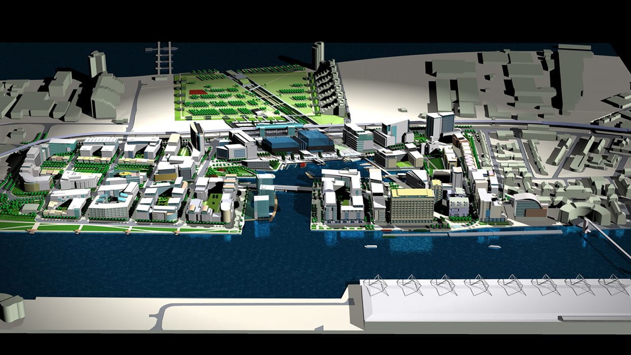
Silvertown Quays (2001 – 2009)
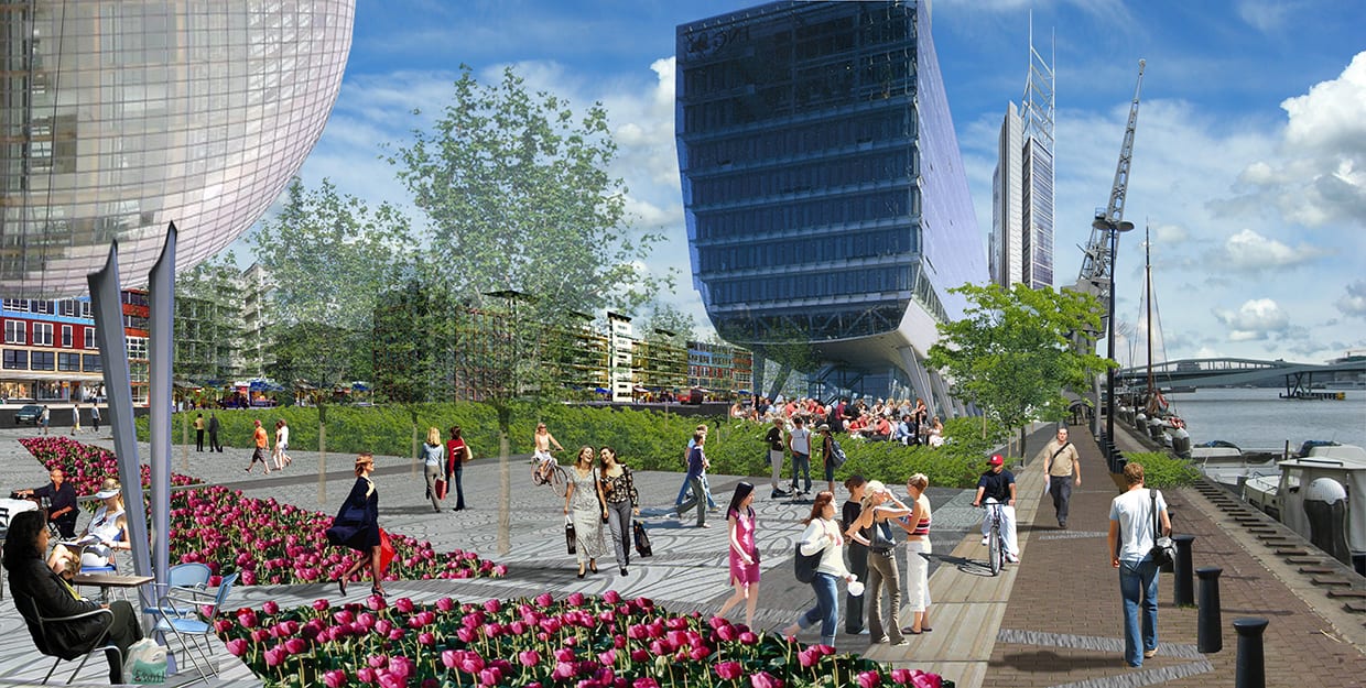
The regeneration of Silvertown Quays, the last large site in the Royal Docks district of London, continues the effort to bring significant new development east of Canary Wharf and the Millennium Dome. As the lead consultant to a multi-national development consortium, Urban Strategies developed a vision and master plan for the 60-acre site that won an international design competition hosted by the London Development Agency. Our plan for Silvertown Quays called for an entirely new mixed-use urban district and an active town centre for the Royal Docks. The proposed network of streets and open spaces responded to the unique dockside location and provided the framework for a range of commercial (40,000m2) and residential (5,000 units) buildings along with water-based recreational facilities. The objective was to create a sustainable community that capitalized on recent investments in nearby regional transportation and open space infrastructure while employing the best environmental practices and job creation for the local community.
Client: Silvertown Quays Ltd. (KUD International and London and Southern Ltd.)
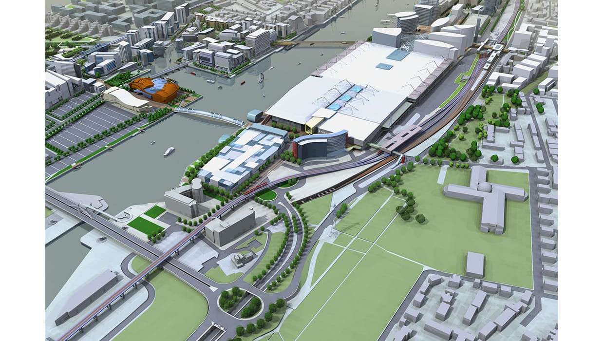
ExCeL (2005 – 2012)
The ExCeL Centre, located in the Royal Docks in East London, is expanding its exhibition and conference facilities to 1 million sq. ft., making it one of the largest centres in the UK, with a national and international draw. As part of the expansion, Urban Strategies is creating a long-term, comprehensive master plan for the entire 100 acre ExCeL estate. This expansion anticipates the physical, functional and economic growth of the East London region as a vibrant, mixed-use destination. It will create an attractive urban setting for ExCeL, capitalizing on its unique waterfront location while enhancing its competitive presence within a broader European context.
Client: ExCeL London
Royal Docks Thameside (2005 – 2008)
Urban Strategies was commissioned to create a contemporary vision for the Royal Docks Thameside area of east London and assess the site’s long-term development potential. The Royal Docks is an area facing rapid growth pressures due to its location in the heart of the Thames Gateway and the site’s proximity to the City Airport, Canary Wharf, the Lea Valley Olympic corridor, Canning Town and the Greenwich Peninsula. Our proposal plans to transform the underutilised industrial areas into a more mixed use, transit oriented ‘city within the city’ that builds on open space assets and recent transit investments to the Docklands Light Rail and the proposed Crossrail. A parks and public space strategy would link disparate and isolated parks, connect the Royal Docks to the Thames, establish a new premier park and canal link at Thames Wharf, define neighbourhood character and structure, buffer communities from ongoing wharf use and establish a district approach to public space. Our plan accommodated a residential population of 65,000 people, provided opportunities for 15,000 new jobs and an accommodated array of civic, cultural, community and retail amenities. We are currently in on-going informal discussions with the GLA regarding the future of this area.
Client: Ballymore Properties Limited
Glengall Bridge, Isle of Dogs (2005)
The Isle of Dogs is a growing success. As Canary Wharf continues to expand, the second regeneration of the Isle continues to gather momentum. Recent developments and current applications attest to a significant demand for housing, commercial office and other uses. However, despite recent planning initiatives, there lacks a compelling vision for the Isle of Dogs, especially for its heart in Millwall Dock. The development community has responded to this visionary void with a mix of disconnected and inconsistent projects.
Located at a crossroads of two significant physical and visual spines, Glengall Bridge is one of the key sites within the Isle of Dogs. The north-south axis, extending from Greenwich to Canary Wharf along Millwall Dock intersects an east-west spine connecting river’s edge to river’s edge via Millwall Outer Dock and Mudchute Park. Building on such a pivotal site requires expanding the field of vision to consider the surrounding context. There is an extraordinary opportunity to build on the unique sense of place defined by Millwall Dock and Mudchute Park in bringing the heart of the Isle to life. Urban Strategies developed a master plan in the spirit of inspiring a common vision for the future of the Isle.
Client: Rowan Asset Management
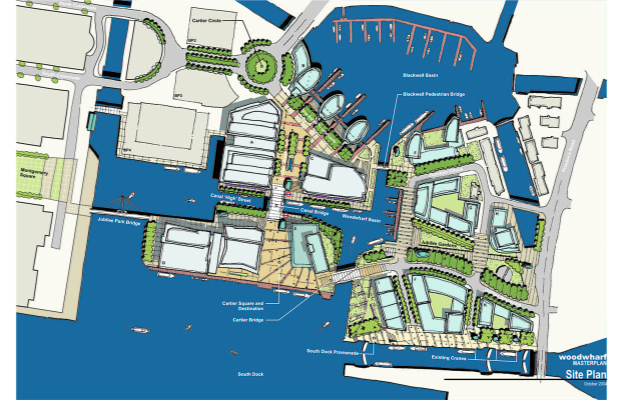
Woodwharf Redevelopment
Woodwharf represents one of the most important waterside regeneration opportunities in the UK, and British Land were invited to submit a proposal to form a partnership with British Waterways for its realisation. Urban Strategies was commissioned to re-evaluate the current masterplan and design a new approach which better suited British Land’s vision of both the proposed partnership and master plan direction.
Woodwharf is the place where east meets west in the Isle of Dogs, where the metropolitan scale of the existing Canary Wharf complex must transition in height to the neighbourhood scale of Prestons Road. Woodwharf becomes the eastern face of development around the transit hub to the west. It establishes the pedestrian and vehicular connections for east-west and north-south access. It is the place where water becomes a vital part of the development, completing the visual, programmatic and functional water links across the Isle of Dogs.
Based on the development yields projected by British Waterways, the Urban Strategies approach for Woodwharf enabled some 366,500 sq. m. of office accommodation, 2,150 residential units and associated hotel retail and restaurant uses, along with a major cultural destination – all linked underground to new Jubilee Line connections. The opportunity to create a tight mix of uses, particularly with the dramatic series of residential towers around Blackwall Basin, has been seized to make this a more diverse, sustainable development.
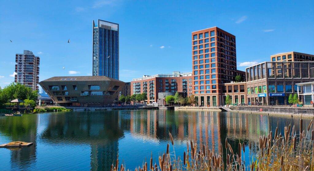
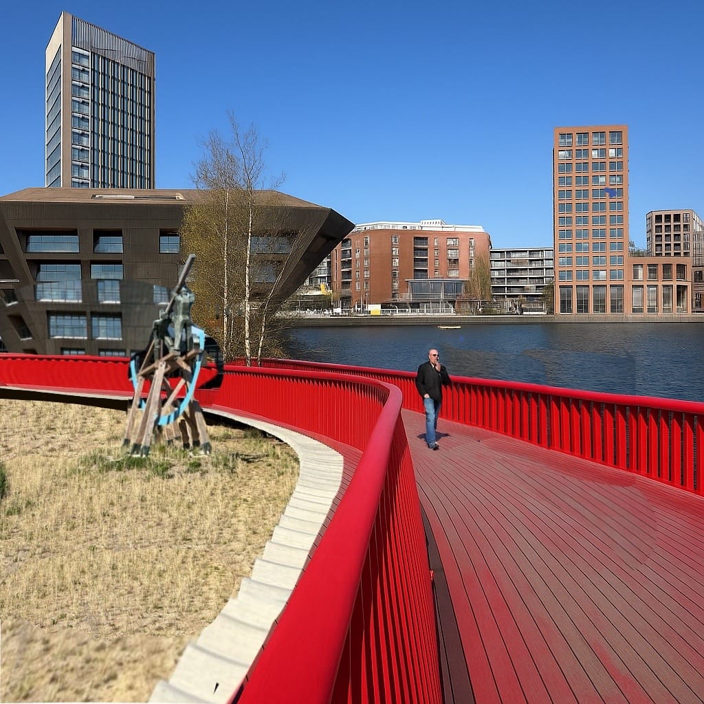
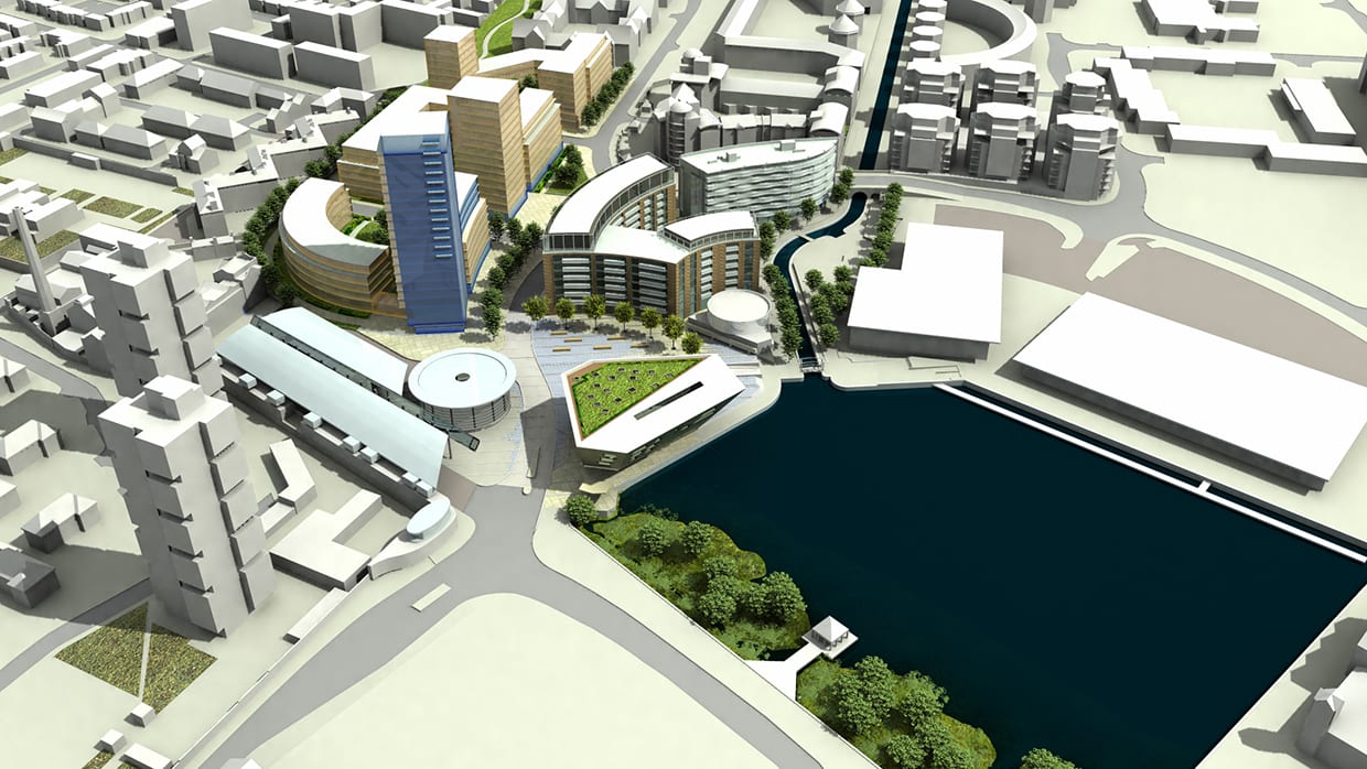
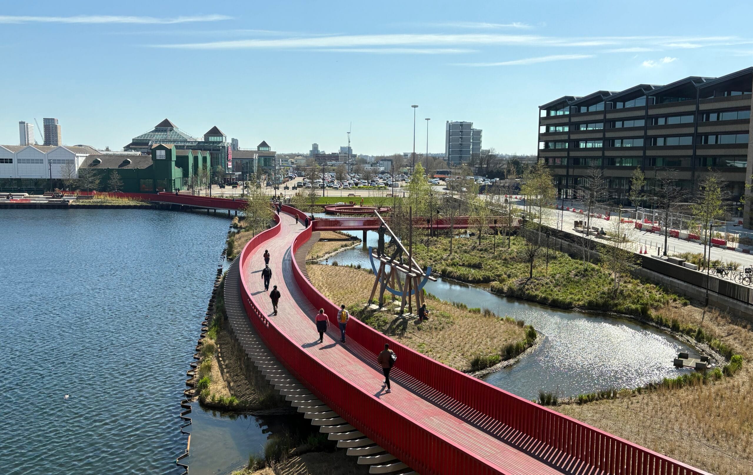
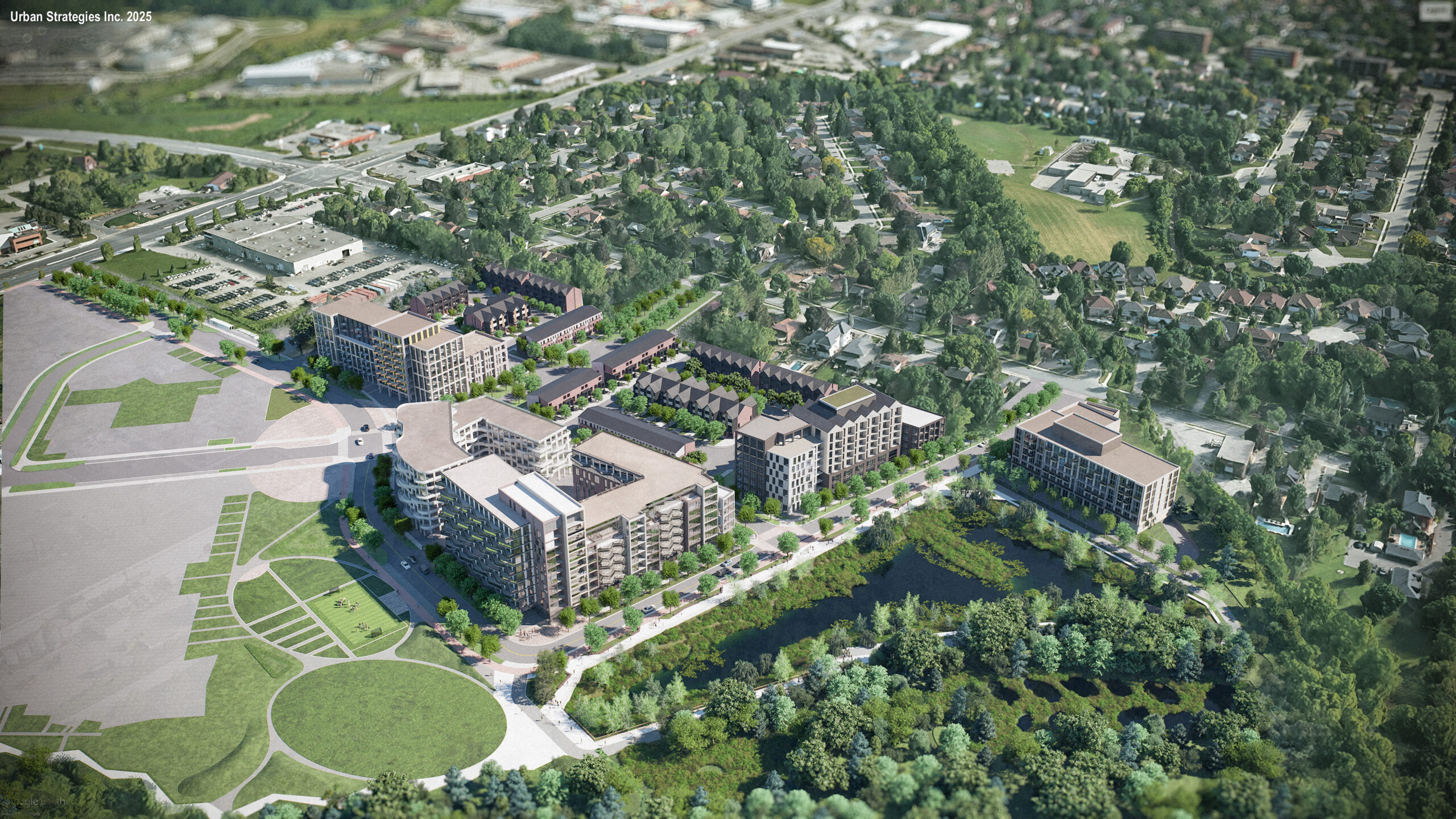
Canada Water Vision and Masterplan (2003-2006)
In 2003, Urban Strategies, on behalf of The British Land Company, won an international competition to regenerate the 40-acre Canada Water site in London’s Docklands. Once an active dock until 1969, the area had declined into underused land, derelict buildings, and a fragmented road network. Urban Strategies led an international consultant team to deliver a bold vision, master plan, and implementation strategy to transform the site into a vibrant mixed-use community.
The master plan balanced the aspirations of local communities with the commercial opportunities of the site’s proximity to Central London and Canary Wharf. In collaboration with Southwark Council and the community, the eastern portion of Canada Water has now been successfully delivered. The result is a lively, sustainable neighbourhood anchored by a new public plaza with a library, retail, and community facilities adjacent to the Canada Water Underground Station. The first phase has delivered over 750 housing units (including 25% affordable and 10% key worker units), now home to over 1,500 residents. At the heart of the redevelopment is the historic Canada Water basin, reimagined as a protected wetland and focal point of the public realm. A carefully articulated network of tree-lined streets, squares, and waterfront promenades ties the district together, reconnecting Canada Water to its wider urban context and creating a model for community-focused regeneration.
Client: The British Land Company
Key Team Members

Joe Berridge

Michel Trocmé

Eric Turcotte

Dennis Lago

Geoff Whittaker

Mihaly Szabo
Project Details
Related Projects
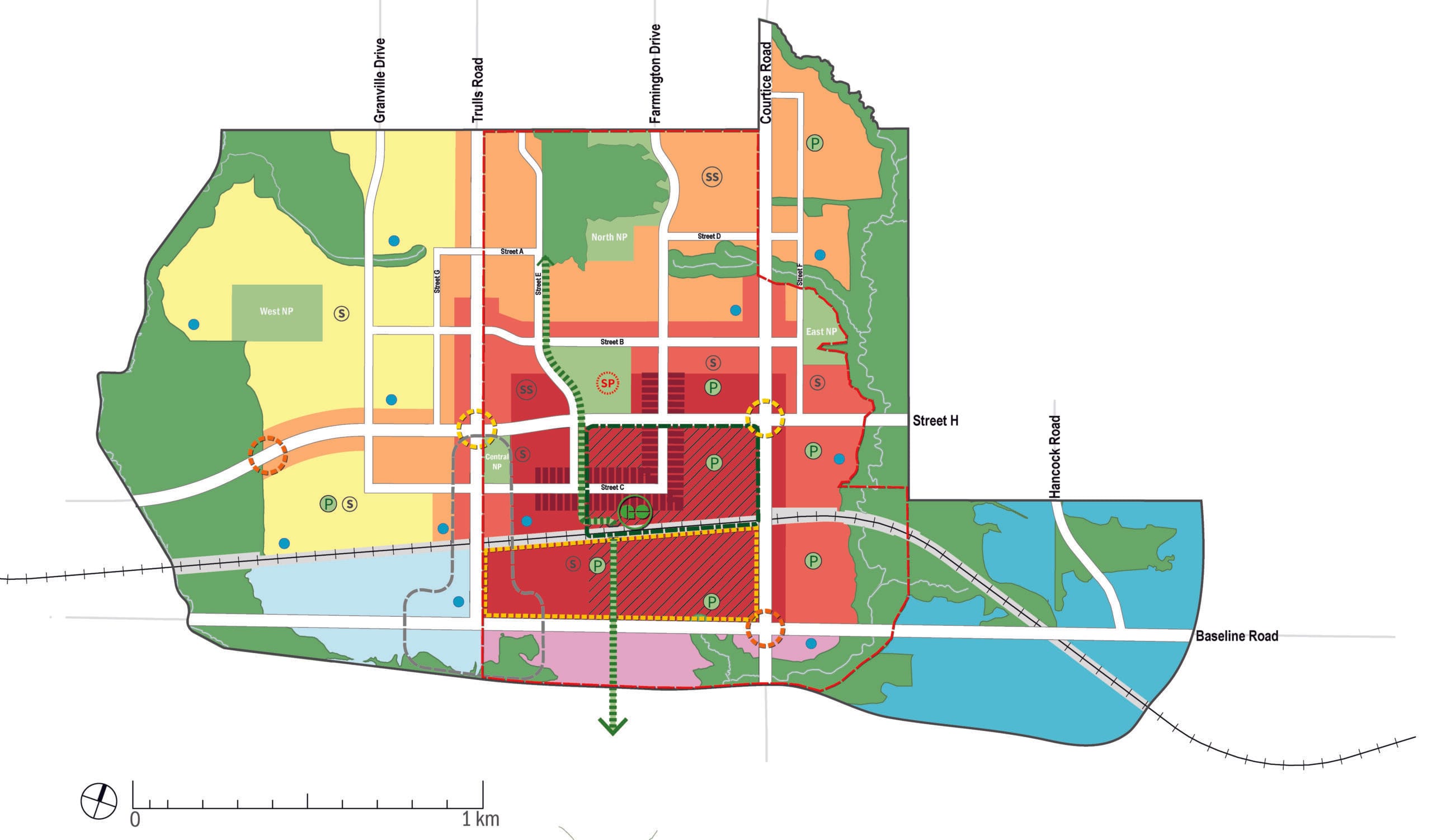
Courtice Secondary Plans
Our secondary plans for Courtice set the stage for development of a complete, transit-oriented community well connected to Lake Ontario.
150 Steeles Milton
Revitalizing a former industrial site to create a new valleyside neighbourhood on the edge of downtown Milton.